
Transit Tour Guide:
Boston
Boston is a transit city. Thirty-seven percent of households do not have a car. Rail covers the city’s major employment centers and dense urban neighborhoods and a dense network of frequent-bus routes fill in the gaps. The city is—and always has been—walkable and mixed-use.
Boston has a long transit history. A local railroad offered America’s first commuter tickets in 1843. The Orange Line is one of the oldest heavy-rail lines in the country. The light-rail Tremont Street subway, still in operation as part of the MBTA’s Green Line, was the first subway line in the United States, and the third in the world. That history is still obvious. But Boston’s transit system is also quite modern. No other prewar rail-transit network in the United States has transformed like Boston’s, with old elevated lines rebuilt in new corridors, and lines extended further into the suburbs to new park-and-ride stations. Boston was the first US city to convert a railroad line to light rail. The commuter-rail system has been expanded from a low of 240 miles in 1980 to 400 miles in 2018.All this makes Boston an essential stop for anyone interested in North American transit, and a very fun place to explore.
Note: In September 2022, all of the Orange Line and some of the Green Line are closed. See the MBTA website for more details and replacement shuttle buses.


Park Street [1] is one of the oldest subway stations in the world: only London, Glasgow, Budapest, and Istanbul have older underground trains. The upper Green Line station at Park Street opened in 1897; the lower Red Line level was added in 1912. Both retain their historic configuration and structure, with some new finishes on top. The Green Line level is quite complex, with four platform tracks and a turnaround loop. Just down the road, Boylston [2] is equally old, and two historic streetcars are displayed inside on an abandoned track. Downtown Crossing and State are similarly old, with some very convoluted underground passages. The latter has the most historic subway entrance in America, built into the 1713 State House.
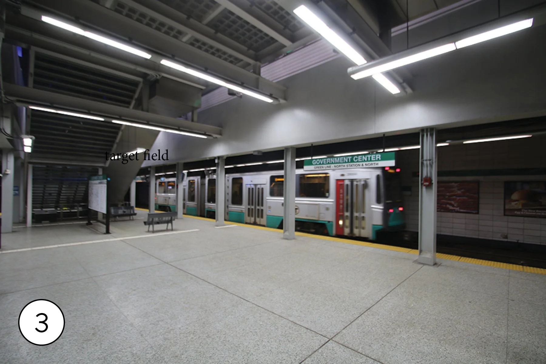
Government Center [3] is the most modern of the Downtown transfer stations, completely rebuilt in 2014-2016 with gleaning white walls and a spacious platform level.
South Station [4] stands at the end of Amtrak’s northeast corridor, with electric Acela and Northeast Regional trains speeding south. 8 commuter rail lines share the same platform tracks. The waiting hall and platforms offer view the tracks; sadly, the bus terminal and new air rights construction limit views of the tracks into the station. Underground is the Red Line and an underground BRT loop that forms the terminus of the Silver Line [5]. There are views of the commuter rail tracks further south at the Traveler Street Bridge [6], where they run alongside a subway yard, and at the Shawmut Avenue Bridge [7[ and nearby bridges, where commuter rail runs alongside the Orange line.
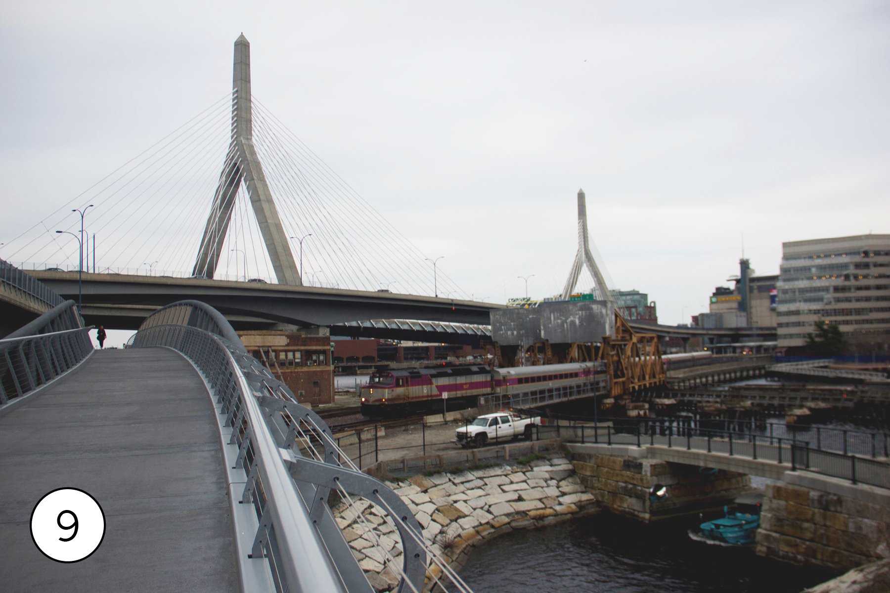
North Station [8] is the hub of the other half of the MBTA’s commuter rail system along with Amtrak Downeaster trains to Maine. The waiting hall (now behind fare gates) offers views, but unlike at South Station there are several great vantage points on the tracks, too. The best is from the north bank of the Charles, where a pedestrian and bicycle bridge spans the tracks. right by the two movable bridges that all train in and out of the station cross [9]. The underground Green Line and Orange Line station was opened in 2004 as part of a project to place this segment of the Green Line underground; it had used an elevated structure. Today, the Green Line comes to the surface a bit to the Northwest; a grade area on top of the portal [10] makes a good photo spot.


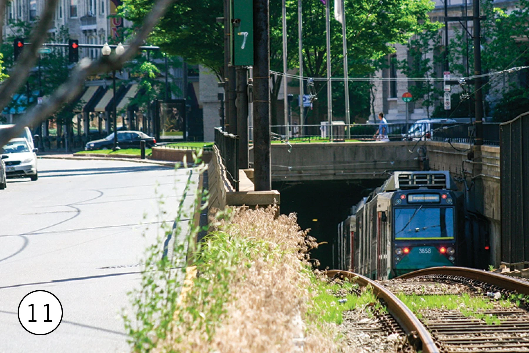
The Green Line is Boston’s oldest rapid transit line; prices have been operating continuously since 1889. The downtown subway segment was built to relieve streetcar congestion the streets of Downtown Boston. Its basic concept — streetcars operating on surface streets, then diving into a tunnel — still applies today. The subway extends from Downtown though the Back Bay area to four different tunnel portals at Northeastern [11] ,Fenway, St. Mary’s, and Blandford.
On the surface, the Green Line generally runs in dedicated lanes, like at Chestnut Hill Avenue [12]. The stations very greatly; some have been rebuilt with full platforms, while others are tiny bits of concrete between the trains and speeding cars. Only one part of the Green Line, the E past Brigham Circle [13], is in mixed traffic. Other such segments have been replaced with buses,. The ends of the branches still feel like old streetcar lines, with loops for turning trains like at Boston College [14]. Along the entire Green Line, it’s obvious that these neighborhoods, like Coolidge Corner [15] grew up around transit,
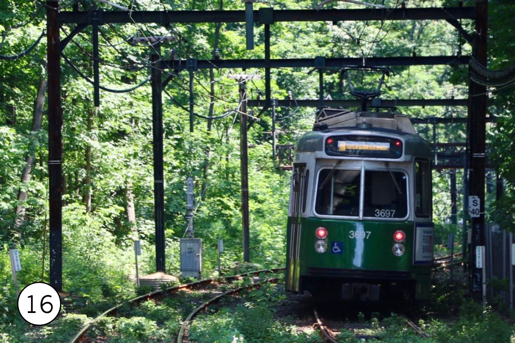
One Green Line branch, the D, is a conversion of an old commuter rail line. Largely grade separated, it feels completely different than the rest of the line. At Longwood [16] the trains are in a tunnel of trees alongside the parkland of the Emerald Necklace. Alongside Reservoir Station [17], where the D and C branches nearly meet, is Reservoir Carhouse, one of four that support the line.
North of Downtown, the Green Line crosses the Charles River on a large viaduct [18]. Science Park station has great views.. It then runs onto a new elevated structure into Lechmere station [19], opened in 2022, It replaced a 100 year old facility that’s still standing across the street, with wooden bus transfer canopies and a tight loop that was a key design limitation for all Green Line trains. Lechmere is the first station in the new Green Line Extension. One branch, already open, extends to Union Square [20], the other will extend to Medford. Both follow commuter rail lines. The Somerville Community Path will offer some great views of the line when it is completed.


The Orange Line, which dates back to 1901, is the oldest of Boston’s three heavy rail lines. None of the original route remains in use by the Orange Line, though (the trains did use today’s Green Line subway), and the only part of today’s Orange Line that predates WWII is the tunnel from Haymarket to Chinatown.
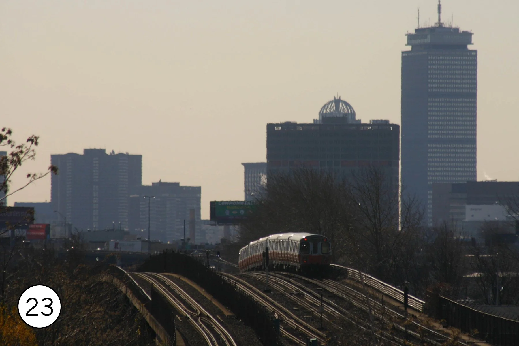
North of Downtown, the Orange Line was relocated in the 1970s to follow the commuter rail lines. Assembly station [21], added to the line in 2014, offers nice views of the line as well the bridge that carries the Newburyport/Rockport commuter rail. At Wellington, a skybridge offers views of the line’s major yard. [22] The station is also a great spot for photos of trains with the skyline in the distance. [23].
South of Downtown, the 1980s Southwest Corridor Project used right-of-way originally intended for a freeway to build a new below grade alignment for the Orange Line, commuter rail, and Amtrak. The first stop here is Back Bay (from Arlington Street, [24]), also an Amtrak stop serving Boston’s second Downtown. The first section of the corridor is largely buried beneath a greenway; past Roxbury Square it’s in an open trench, and cross streets (like Atherton [25]) offer good views, as do some station platforms, like at Stony Book [26] or Ruggles [27], which is also a commuter rail stop. During rush hour, it’s not hard to get a shot of Orange Line alongside commuter rail or Amtrak.


The third of Boston’s downtown subways opened in 1904 to carry streetcars from East Boston. In 1924 it was converted to a heavy rail line, and then in the 1950s it was extended along the right-of-way of a former narrow gauge railroad to Wonderland. The massive platform at Maverick, the outermost of the 1920s stations [28] takes up space once used by a streetcar loop.
The line reaches the surface at Airport [29], where trains switch from third rail power to overhead power while stopped at the station. From here north, stations like Suffolk Downs [30] offer good photos opportunities. The end of the line at Wonderland [31] is one of the few places in the United States where the subway will drop you off at the beach. Belle Isle Marsh is also a great destination here, with distant views of the Blue Line yard [32].


Boston’s newest heavy rail line dates back to 1912. The Red Line is actually the longest stretch of prewar rapid transit still operating in Boston — by 1928 the current line was open from Harvard to Ashmont. North of Downtown, the line is in subway except where it crosses the Charles River on the Longfellow Bridge; the parks along the waterfront offer some great shots of Red Line trains and the skyline [33]. Harvard station [34] has a unique underground busway which hosted trolleybuses until 2022. South of Downtown, it tunneled through South Boston and then followed an old commuter rail line, some of which has been capped to make it a tunnel.
At Ashmont Red Line trains meet one of the oddest transit lines in North America. Rather than extend heavy rail further, the Boston Elevated Railway operated a streetcar shuttle in private right of way largely following the Neponset River. That 2.5 mile line survives in more or less its original form, operated by 1940s PCC streetcars, The only modern section is the 2007 loop at Ashmont [35]. The other stations, like Cedar Grove [36] are small and quaint. The Neponset River Trail offers some great views [37] including of the line’s open air maintenance shop [38]. The Mattapan station is a bus transfer hub.
In the 1970s the MBTA opened a second southern branch to Braintree. The tracks branch off at JKF/UMass; the station and nearby street overpasses offer great views of the complex track work, including the parallel commuter rail lines [39]. The bridge across the Neoponset feels almost rural. The large stations in Quincy offer some photo spots from street overpasses.
In the 1980s the line was extended north. Porter Square [40] is the deepest station on the system, with a unique 2-level configuration and classic 1980s architecture. The end of the line at Alewife is under a gigantic parking garage with direct ramps from Highway 2.


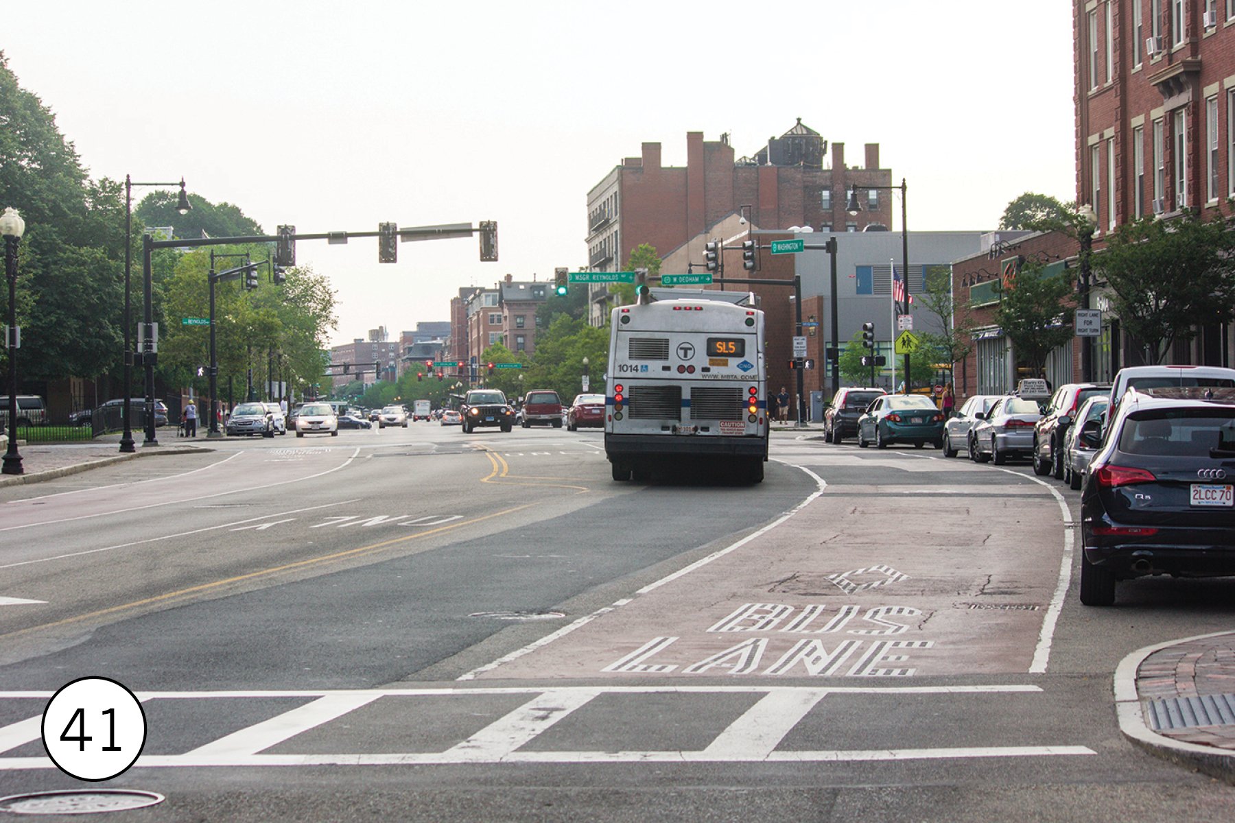
The newest subway in Downtown Boston is actually for buses. The South Piers Transitway opened in 2004 as part of the redevelopment of former railroad yards and port facilities into the Seaport District. It was intended to be part of a through tunnel, but due to construction complexities and budget increases the segment from South Station on to Boylston and Washington Street was cancelled in. 2010. Thus, there are two disconnected parts of the Silver Line: SL 4 and SL 5 are rapid bus south from Downtown to Nubian in curbside bus lanes [41]; SL 1, SL2, and SL 3 use the tunnel. The Seaport stations (like WTC [42] feel entirely like subway stations, just with buses. The tunnel comes to the surface at Silver Line Way [43], where the current fleet of dual-mode buses drop their trolley poles and start their diesel engines before branching out to the three routes. SL 1 and SL 3 go under the harbor on the freeway; SL1 ends at the airport terminals while SL3 head to Chelsea, The northern end of SL3 uses a 2018 busway; the Broadway and Washington Avenue bridges have great views of buses and the parallel commuter rail lines [44]. (It is worth noting that the Boston region contains several Washingtons and a multitude of Broadways.; never tell anyone you’ll meet them at the Dunkins on Broadway.)


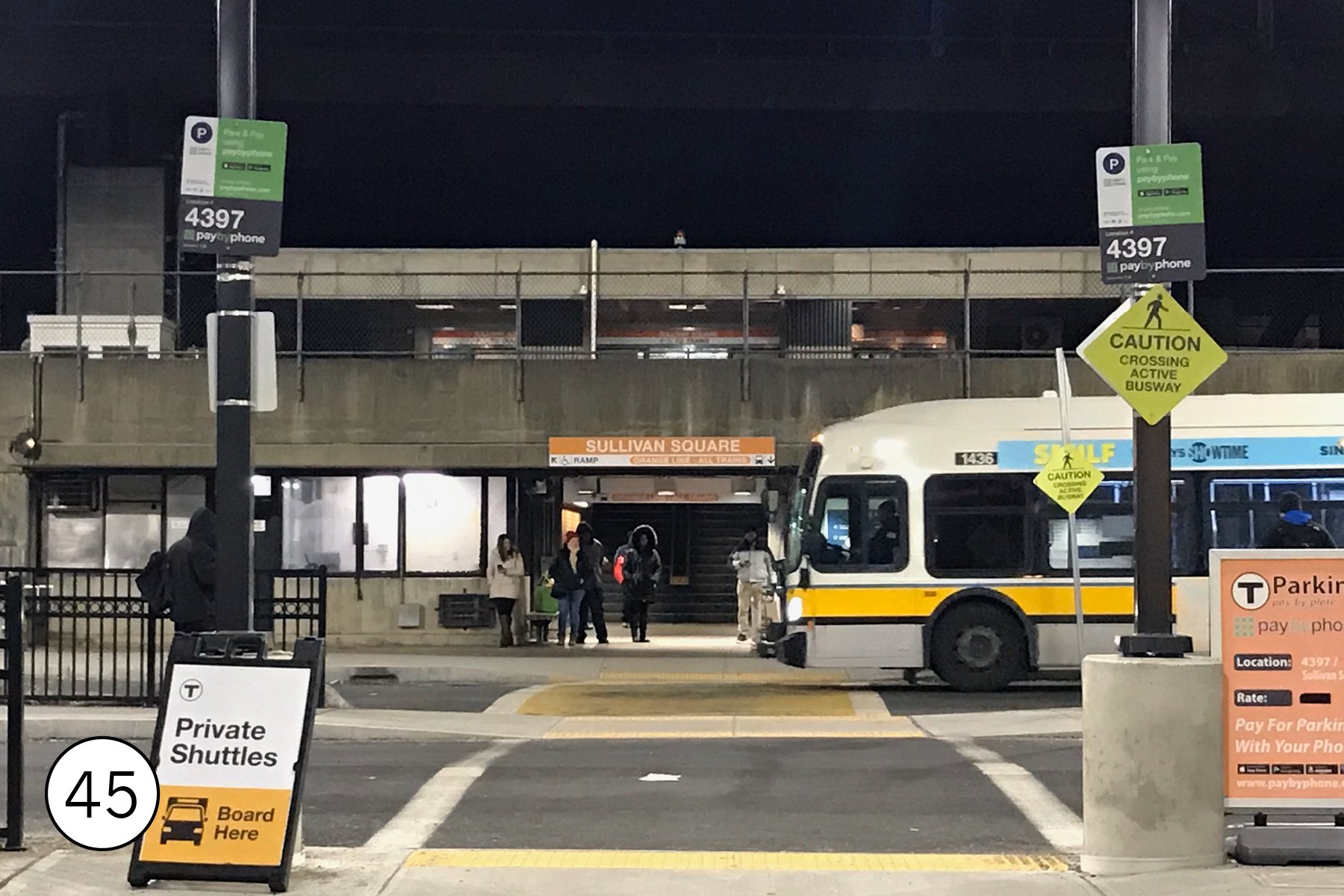
While the rail lines cover some neighborhoods, they have big gaps, and Boston is still very much a bus city as well. The two systems have always worked together. Boston Elevated Railway built streetcar transfer loops right into rapid transit stations, and MBTA has continued that. Some of the best places to appreciate the bus network are at those hubs, like Sullivan [45], Ruggles, Forest Hills [46.], and Kenmore [47]. Nubian [48], a former rapid transit station, also remains one of the busiest hubs on the system and a great place to get bus photos.
In the last 5 years, MBTA has made a dramatic effort to get buses out of traffic and into bus lanes. Most of these, like the lanes on Broadway in Everett [49] are simple but still effective paint in curb lanes. The Columbus Avenue lane south of Jackson Square [50], though, is much more ambitious center-running bus lanes for local bus service, implemented in only 2 years from start of planning to revenue service.


The Boston commuter rail network, inherited by MBTA from Boston & Maine, the New Haven, and the New York Central in the 1970s, is massive: 13 lines, 140 stations, nearly 400 miles. Some lines have been operating continuously since the 1830s, but MBTA has also expended the system: the “Old Colony” lines through Quincy were reopened in 1997 after nearly 40 years of no service. The network is very much traditional commuter rail: diesel locomotive hauled trains, conductors collecting fares, and rush hour focused service. Lines do operate (relatively infrequently) all day and on weekends, though, so it’s possible to explore.
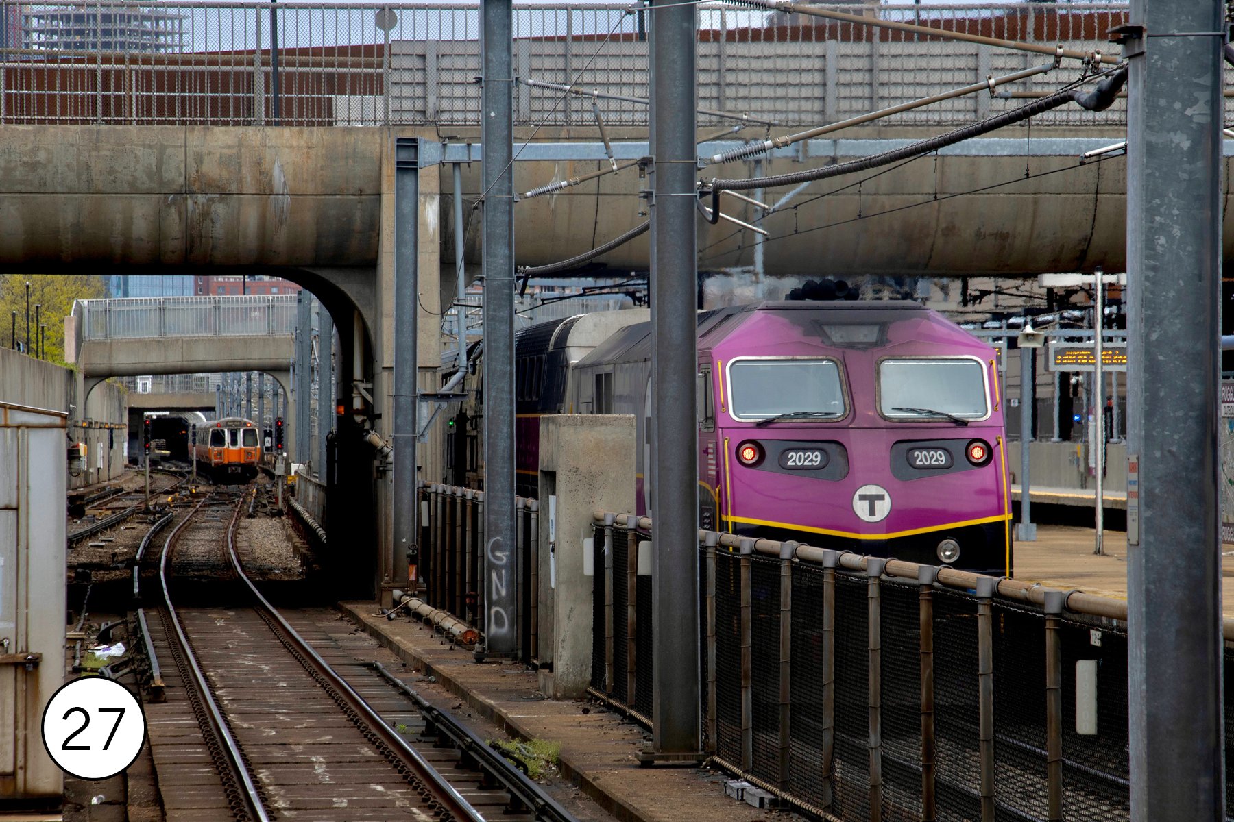
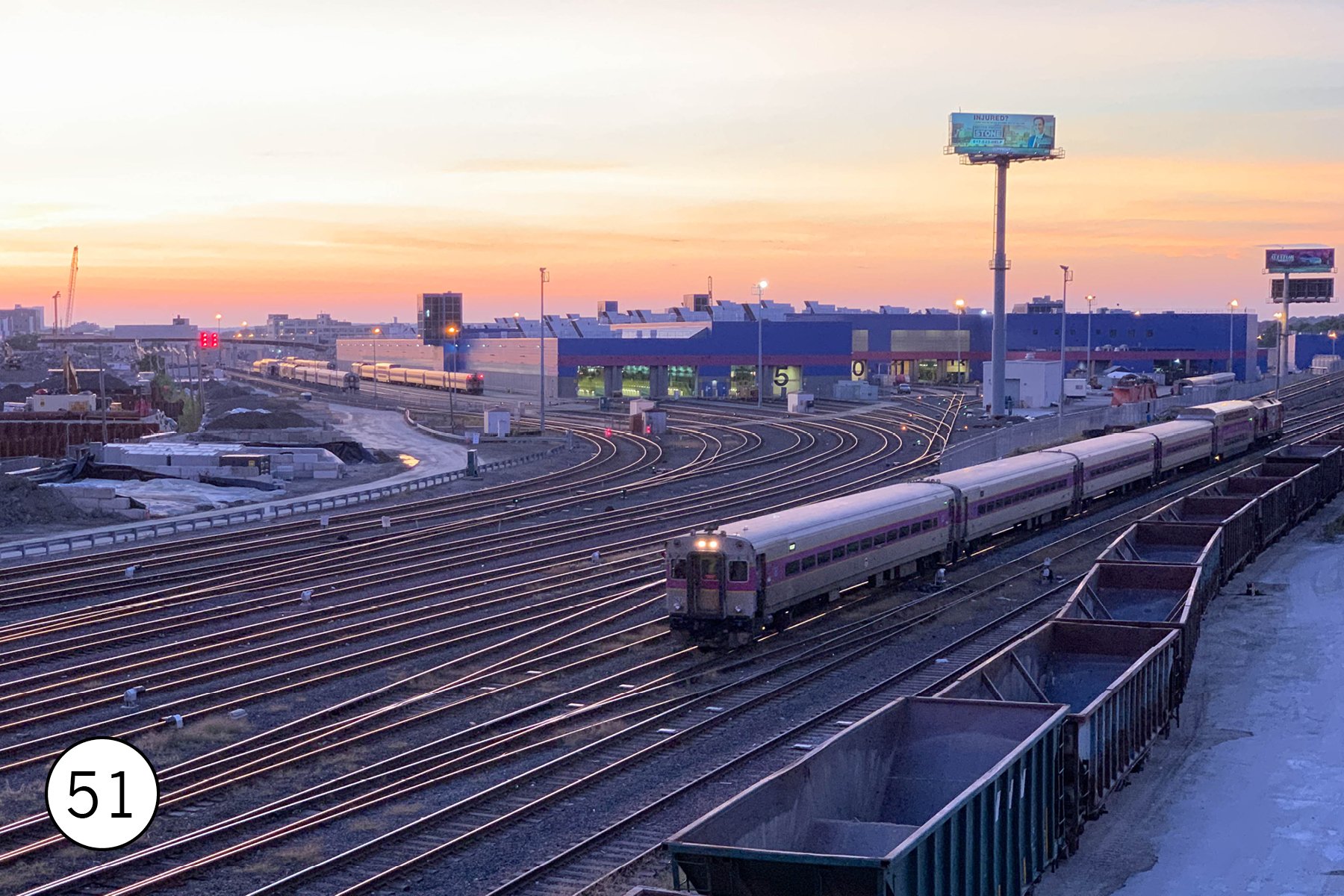
In the center of the system, it easy to use rapid transit to photograph commuter rail. The Red, Orange, Silver, and Green lines all parallel commuter rail in segments. The tracks in the core are usually grade separated and often below street level, so there are lots of locations with good shots. The yards for South Station (near Andrew on the Red Line) and North Station [51] (near Community College on the Orange Line) are also visible from street overpasses.
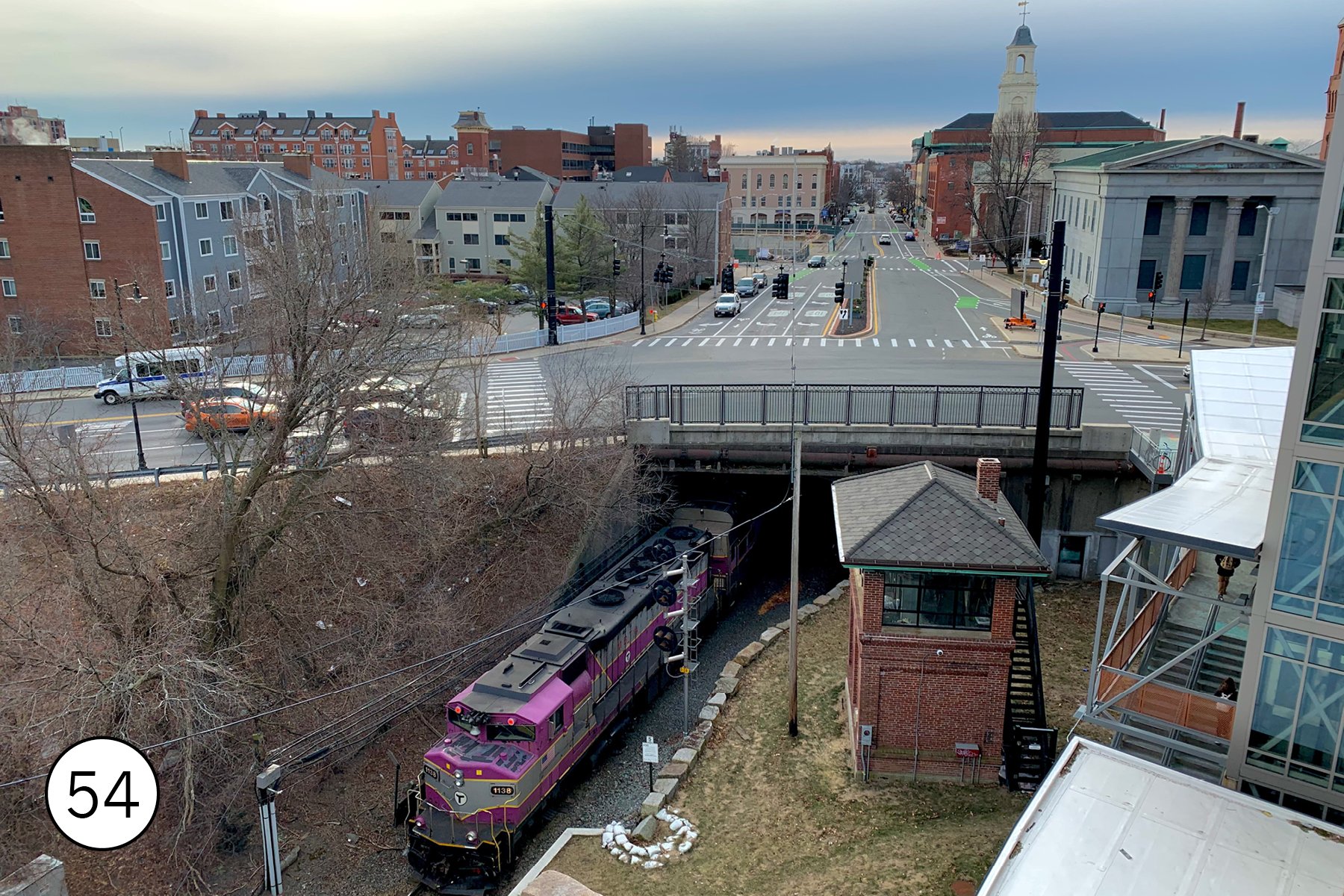
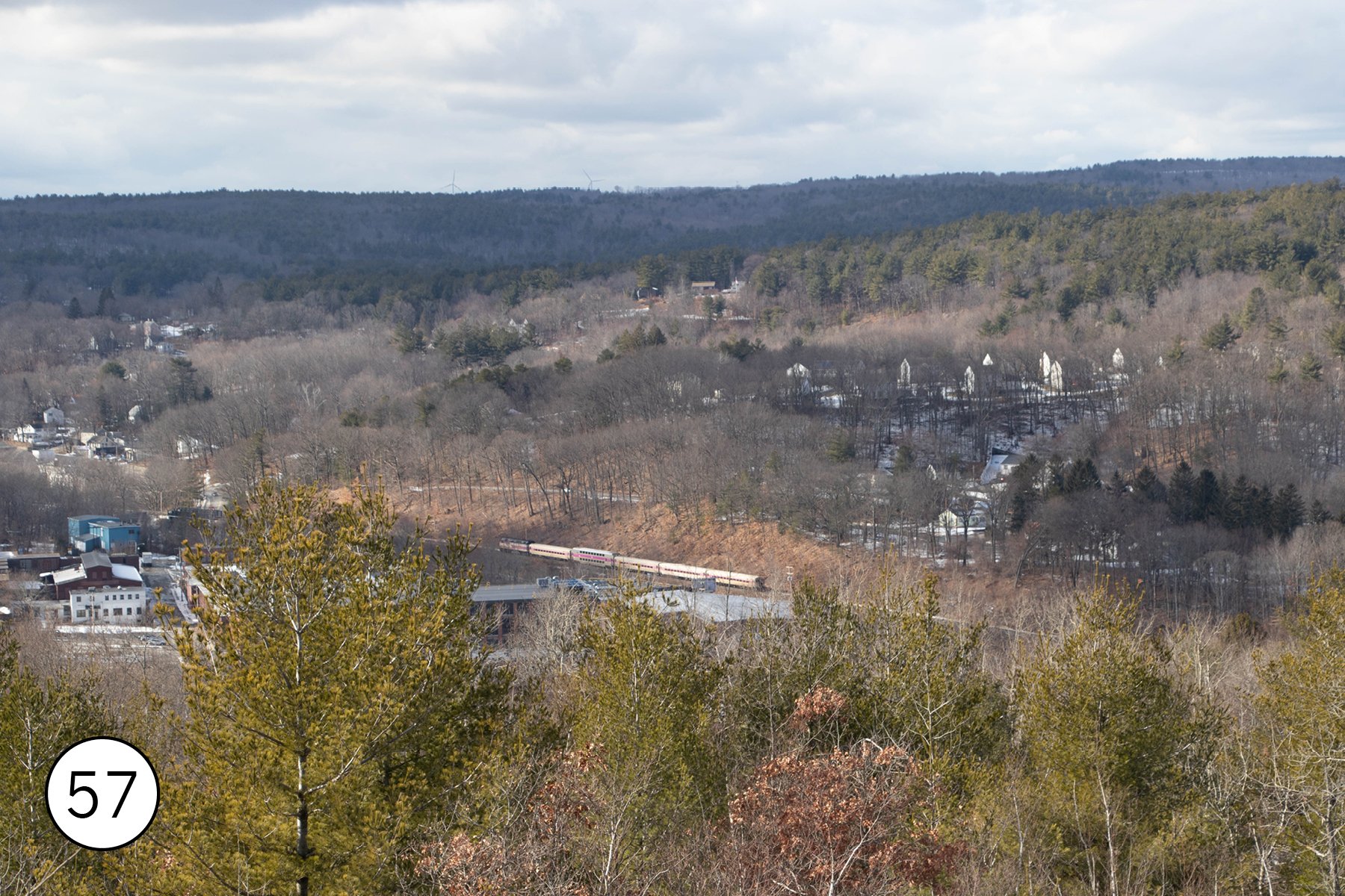
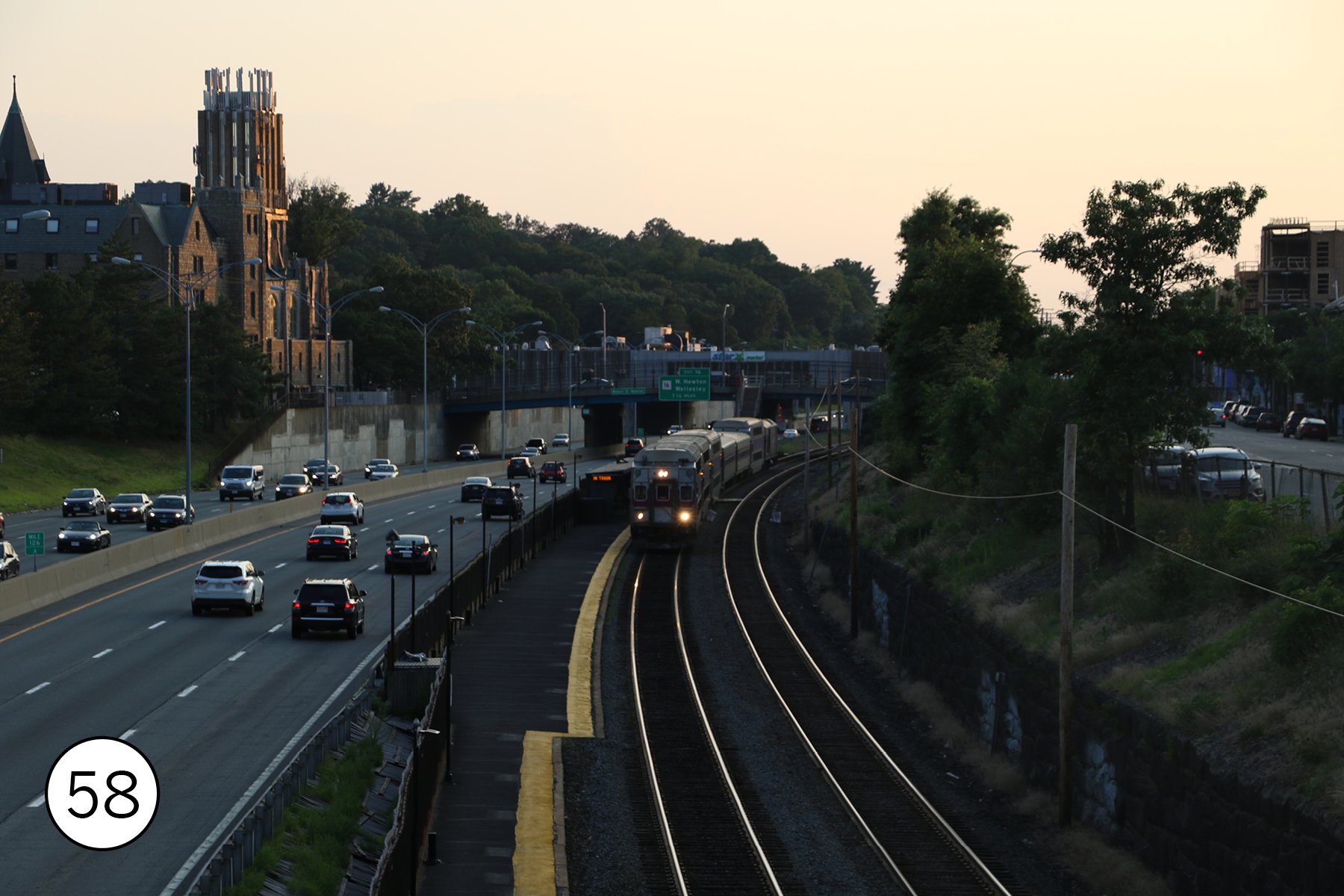
Further out, the small towns and scenic landscapes make for great photo spots. In Readville [52] a complex junction makes for s good shots; there’s a also a small yard. In Canton [53], high speed Acelas and MBTA trains cross one of the oldest railroad bridges in the world. In Salem [54] trains use a single track tunnel that dates back to 1839; the station platforms and parking garage offer great views. In Lowell [55], the trains terminate in an old mill town with a great National Historic Park. In Concord [56], the trains run past Walden Pond, where Thoreau watched them pass in between writing and having his mom do his laundry. In Fitchburg, a hike up the hills reveals view of the trains in the valley below [57]. In Newton, trains are squeezed alongside the Massachusetts Turnpike [58]. At its outer ends, the system reaches other cities, like Worcester [59], where the historic Union Station is also as a bus hub, and into Rhode Island to Providence, which has an interesting transit system in its own right, including a bus only tunnel under College Hill [60].


The lowest ridership MBTA mode is the ferries, which are generally the slow but scenic way to get around. The Charlestown route [61] is a nice short ride across the harbor with great views; the other routes go to suburbs to the south, with some trips stopping at the airport.

Getting around
The CharlieCard (plastic) or CharlieTicket (paper) works on subway, light rail, and bus. The plastic version is available from the agent at some subway stations and at some retail stores; the paper version is available from ticket vending machines at any subway station and other locations. A single ride costs $2.40 on subway or $1.70 on bus, with up to 2 transfers. A day pass is pricy at $11 but a 7-day pass is a good deal at $22.50.
Commuter rail uses a different ticket system. Major stations have ticket vending machines; you can also pay the conductor in cash. The easiest way to pay may be the the mTicket smartphone app. Charlietickets with daily or weekly passes also work in Zone 1A. One way fares vary from $2.40 to $13.25. A $10 mTicket pass offers unlimited commuter rail rides for one weekend, from Saturday morning to Sunday night; that’s almost always the best deal for weekend travel.
Ferries use mTicket and have manned fare ticket booths as well, Charlietickets with daily or weekly passes also work on the Charlestown Ferry.
An extensive bike share network (https://www.bluebikes.com) covers Boston and other urban core cities.
Getting there
There are two major transit routes from the airport into Boston. The Silver Line stops right at the terminals, then runs through the Seaport to South Station. If you’re headed to those places, or anywhere on the Red Line, it’s the best bet. It’s also free: you board the bus at the airport without a ticket and can ride to anywhere else on the rapid transit system by transferring within the fare gates at South Stations. There’s also a frequent shuttle from the terminals to the Blue Line; that’s the best way to get to some parts of downtown Boston, and it can be faster than Silver Line to destinations on the Green or Orange lines. TF Green airport in Providence is also an option; it has infrequent weekday only commuter rial service to Boston (and bus connections to Providence.)
Boston is on Amtrak’s Northeast Corridor, with lots of service all day to New York, Philadelphia, DC, and points between, with connections across the Northeast. There’s also service to Maine and one train a day to Albany and Chicago.
Thanks to Amtrak and bus service, it’s quite easy to combine a trip to Boston with New York or other cities in the Northeast.