
Transit Tour Guide:
Toronto
Toronto is a peer to Chicago, Philadelphia, New York or Boston — a historic city full of dense, walkable neighborhoods surrounding a downtown that’s still a center of retail and entertainment as well as employment.. Like those cities, it has century-old rail lines still carrying hundreds of thousands of people every day. But Toronto is also a modern city. It did not become Canada’s largest city and eclipse Montreal as a financial center until well after World War II. The transit system reflects that, too. Toronto has. postwar subway that’s transformed its skyline, Its commuter rail system was started more or less form scratch in the 1960s, 70s, and 80s — and now carries more passengers than any other North American system except New York and Chicago. The metro area has 1980s technological experiments, shiny new subways, and extensive suburban BRT. Greater Toronto should be on the agenda of anyone who’s interested in transit..
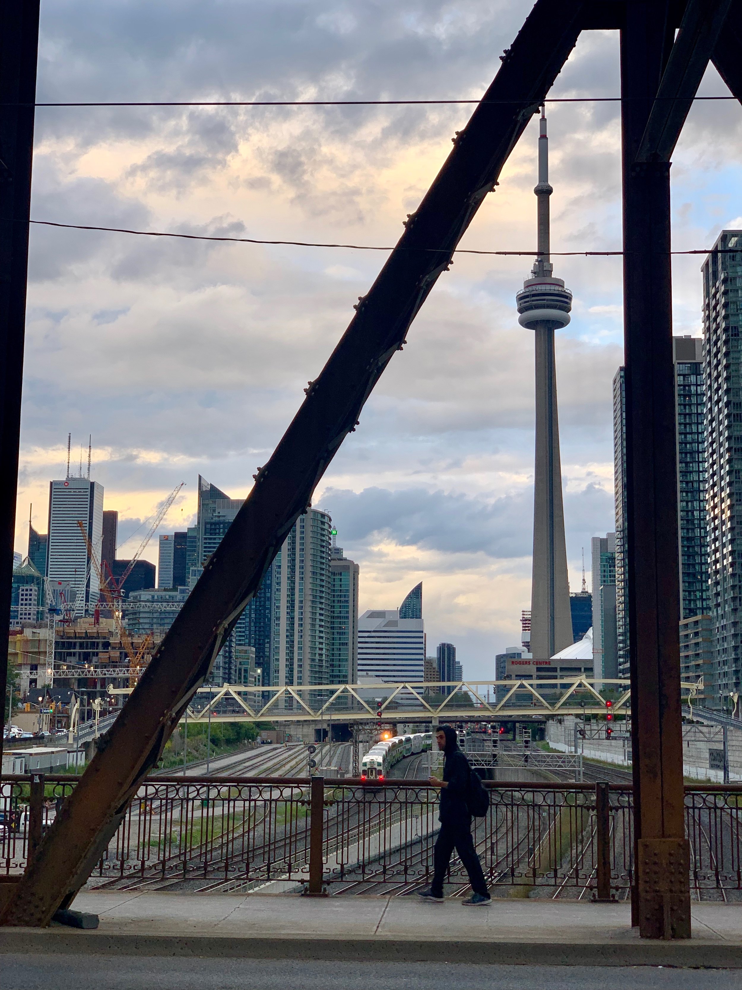

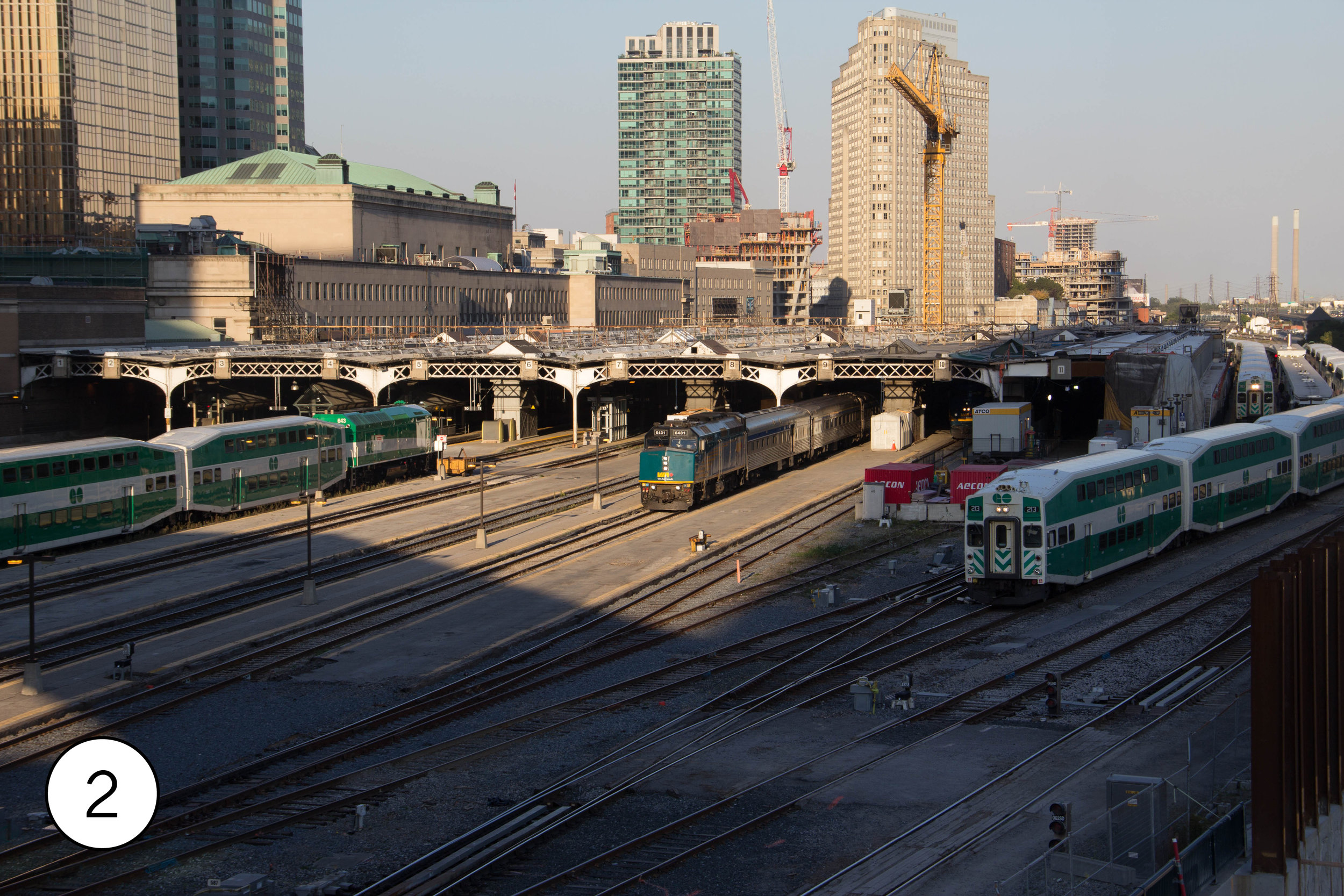
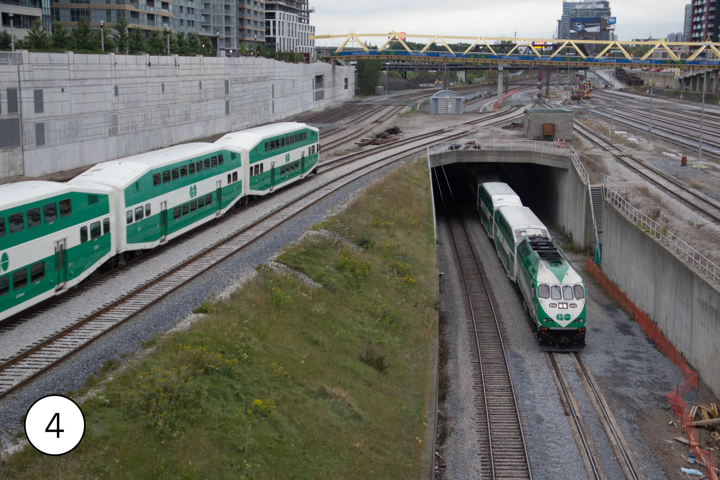
Union Station [1], at the foot of Downtown near the shore of Lake Ontario, is the largest train station in Canada. Its 16 tracks are the hubs of both the regional Go Transit commuter rail system and the national Via Rail system. The building, opened in 1927, has a spectacular great hall the leads to the. underground concourses to the platforms. The skywalks that connect the station to the nearby convention center have nice views of the ends of the station platforms [2], and the terminal for the Union Pearson Express airport trains [3]. The Spadina Bridge to the west looks out over the maze of tracks leading into the stations, including an underpass that simplifies the flow of trains into the station from the branching routes leading into it [5] and a Go Transit storage yard. The Bathhurst bridge has similarly spectacular views. Perhaps the most spectacular —but also pricy — view of Union Station is from the observation deck of CN Tower, the tallest free-standing structure in the Western Hemisphere. [5]
Union Station also has two underground stations: a subway station on the north side with a daily ridership of 143,640 people a day, and an underground streetcar station on the south side whose single platform is located on an alarmingly tight turning loop. [6[
The waterfront is 4 blocks behind the station. The waterfront streetcar line, the first built after Toronto decided in the late 1960s to keeps its streetcars, emerges from the Union Station tunnel sand runs down Queens Quay in dedicated lanes [7]. At the foot of Bay Street is the terminal for the ferries [8] that run out to the Toronto Islands, a peaceful park with spectacular views of the downtown skyline.


The most unusual thing about Toronto transit is the streetcars. Toronto is the only city in North America that kept most of its historic streetcar network — 52 miles — intact. Here’s it’s still possible, in places like Parkdale [9] to see neighborhoods and commercial corridors that were built around streetcars a century ago and still have streetcars gliding through them, full of people. It’s a bit of a time capsule, full of archaic features like end-of-the-line loops and boarding from the street, but also an essential part of Toronto. The streetcars are the busiest surface routes in Toronto, carrying 468,800 trips on an average weekday. That’s more than any light rail system in North America.
In Downtown, there are four busy east-west streetcar lines in the space of a mile: King, Queen, Dundas, and College. Each connects to two stations, like St. Andrew [10] on the U-shaped north-south subway. The busiest, King Street, was transformed in 2017 as a. pilot project, [11] severely restricting car traffic and creating safe boarding areas for passengers. That has now been made permanent. On the other three streets, streetcars are in traffic as they always have been, and passengers board from the street, like at College Station [12].
To really experience the essence of Toronto streetcars, though, it’s worth going out into the neighborhoods. One good spot is on Broadview east of downtown, where 6 different routes branch meet and branch. At Broadview and Gerard [12], two double track line cross, with connecting tracks in three of the four quadrants. Streetcars squeal around the curves in front of a streetscape that exemplifies both the city’s historic fabric and its diverse population. Nearby, streetcars photogenically run above the green slopes of Riverdale Park [14].
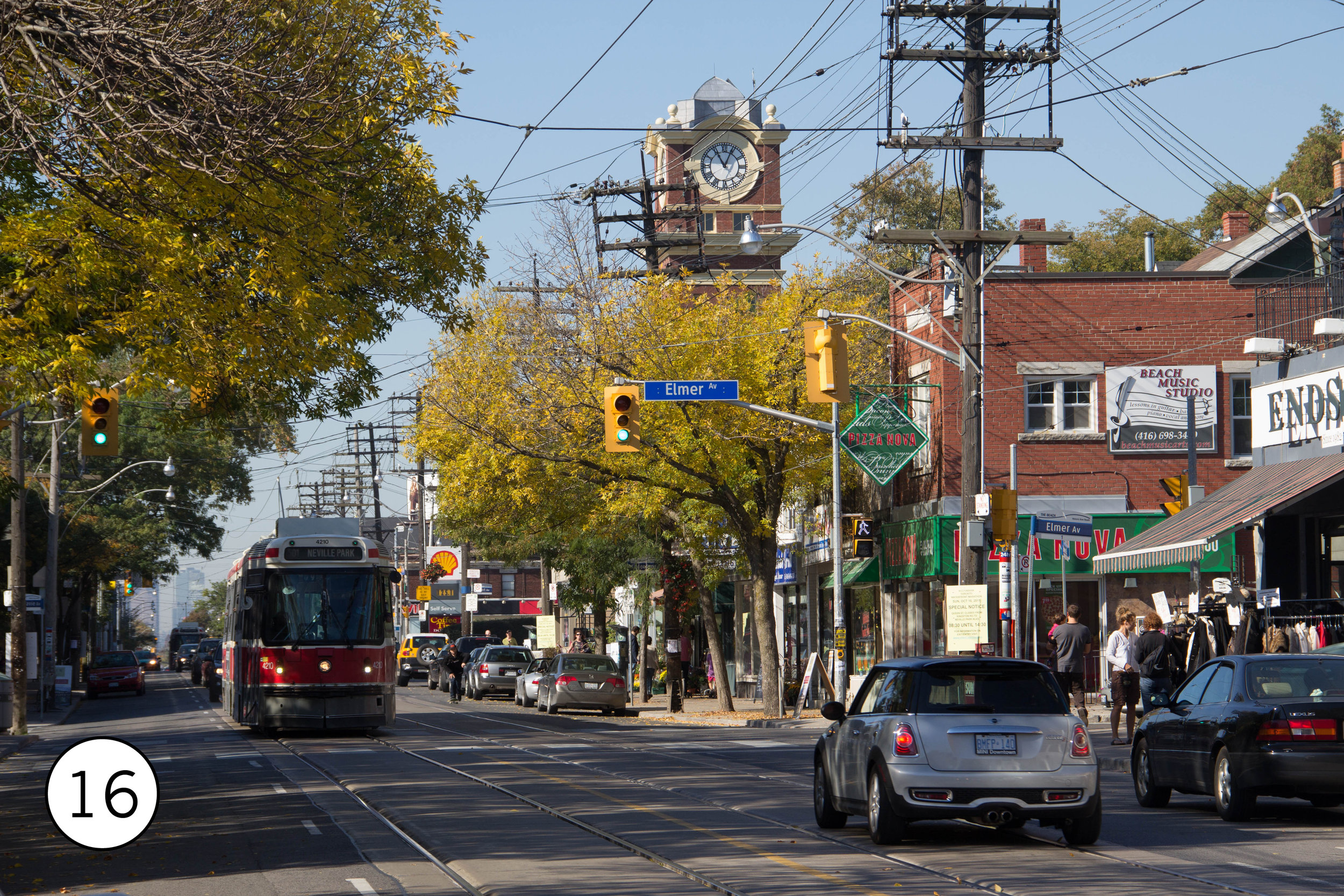
West of Broadview, the streetcars run through typical streetcar suburbs – single family residential neighborhoods, with scattered commercial, built around the lines. On Gerrardnear Woodbine [15], the CN tower stands in the distance as streetcars make the same rounds they have since 1912. Another neighborhood built around streetcars is the affluent Beaches[16] on the shores of Lake Ontario, on the 501
While most of the old streetcar system was in streets within the limits of the old city of Toronto, one line – the 501 – extended west into the suburbs. A large section was rebuilt in 1957 with a dedicated right of way in the middle of a freeway-like section of The Queensway[17]. The Humber Loop[18] in this section still has some of the feel of a quiet rural streetcar terminal, despite the high rise towers in the distance.
While the streetcar system has a shiny new operations and maintenance facility on the waterfront near downtown, much of the fleet still operate out of century-old facilities. Roncesvalles Carhouse [19], located where 5 lines meet on the west side. It’s easy to see (and photograph) from the streets around it. A nearby footbridge has great views across Lake Ontario and the GO and Via line along the lake [20].


In the 1980s, the TTC again began expanding the streetcars. The first new line, opened in 1990, was Harbourfront [6/7]. In 1997, it was extended 2 miles up Spadinain dedicated lanes in the center of the street [21], replacing a bus that has in turn replaced a street line in 1948. The Spadina route crosses 4 other streetcar lines and, at its north end, it connects to both Toronto subway lines at Spadina Station. The Spadina Stationstreetcar terminal is underground, with a short tunnel leading into it. There’s space to stand in the median above the portal [22] and watch the streetcars dive underground.
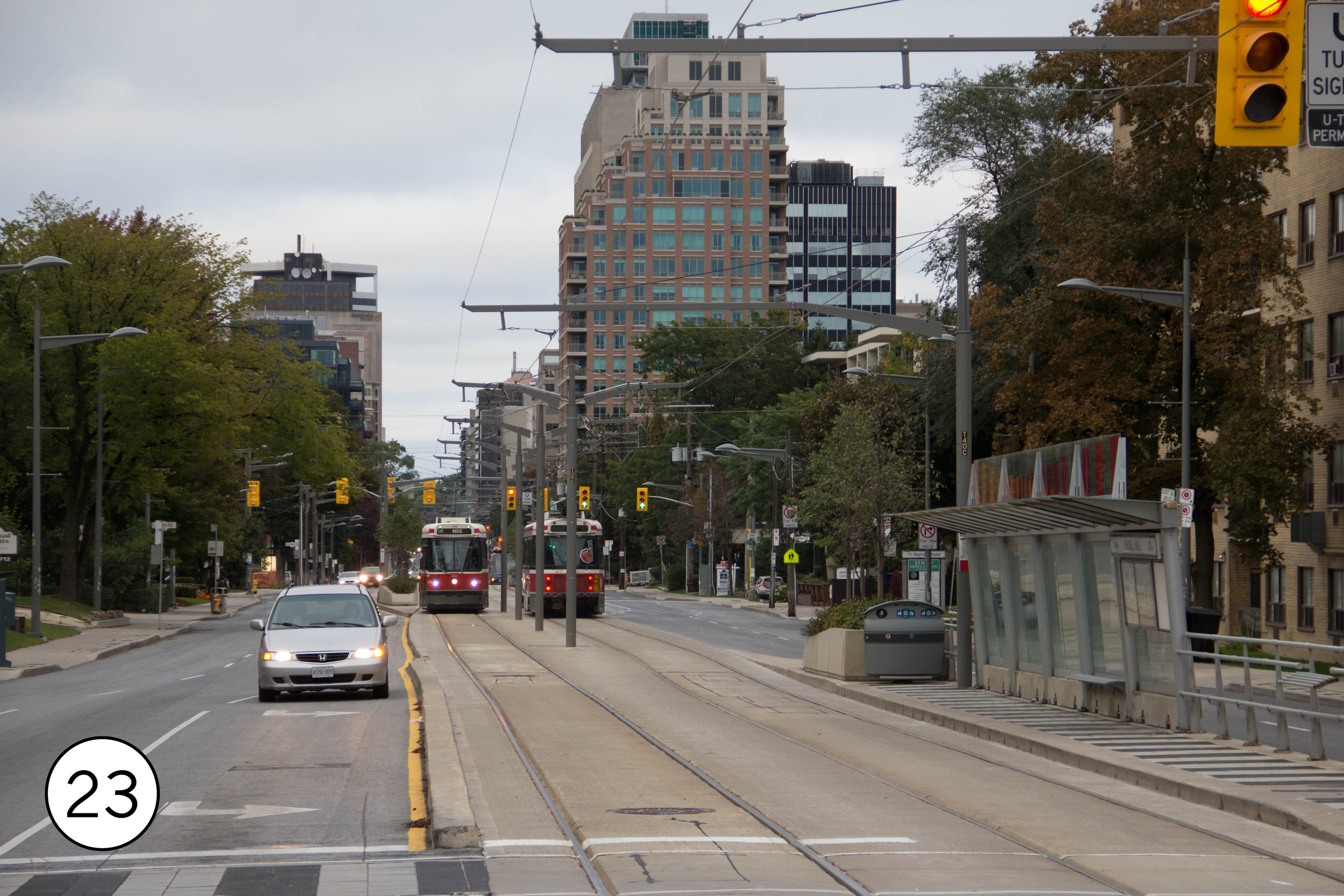
After Spadina, the TTC took on St. Clair. This 4.3 mile line had been operating in mixed traffic; in 2005-2010 it was rebuilt with dedicated lanes in the street median. [23] It connects twice to subway line 1. The eastern connection is an above-ground loop. St. Clair West, though, has an unusual belowground loop. While it’s underground, it’s not a conventional subway station under the street, but a loop of track around an underground platform beside the street. Streetcars enter the subway [24], make a 90 degree turn to enter the loop [25], circle the loop, and then head back out into the street. Diesel buses use the same loop. Opened in 1978 with the subway station, It’s a curious hybrid between traditional streetcar loops and heavy infrastructure, and there’s nothing else like this is North America.


The first section of the Toronto subway opened in 1954, and it has been expended section by section since since. It’s become an integral part of the life of Toronto, even creating a second downtown where lines 1 and 2 cross at Bloor-Yonge. The distinctive subway typography and tiles — which are unique at each station have become so familiar that spacing.casells a line of buttons and magnets covering all the stations. (They also have a physical store at 401 Richmond St. W..) The most unique station, though, is Museum, redecorated in 2008 to reflect the artifacts displayed above it at the Royal Ontario Museum.
At 47 miles, the subway is not unusually long — less than half the size of San Francisco’s BART or DC’s Metrorail — but its ridership is very high. At 1.58 million boardings a day, it carries more people a day than any US rail system other then the New York Subway, or more than BART and Metrorail combined. Its newest trains are open gangway, like all modern subways should be.
Nearly the entire subway is underground, but some of the older sections were built in open trenches — parallel to, not under, the street — and some remains visible above ground. Aylmer Avenue just east of Yonge [28] has a good view of Line 1. Subway Line 2 also travels aboveground near as it crosses to Don Valley near Castle Frank station and east of Victoria Park station.
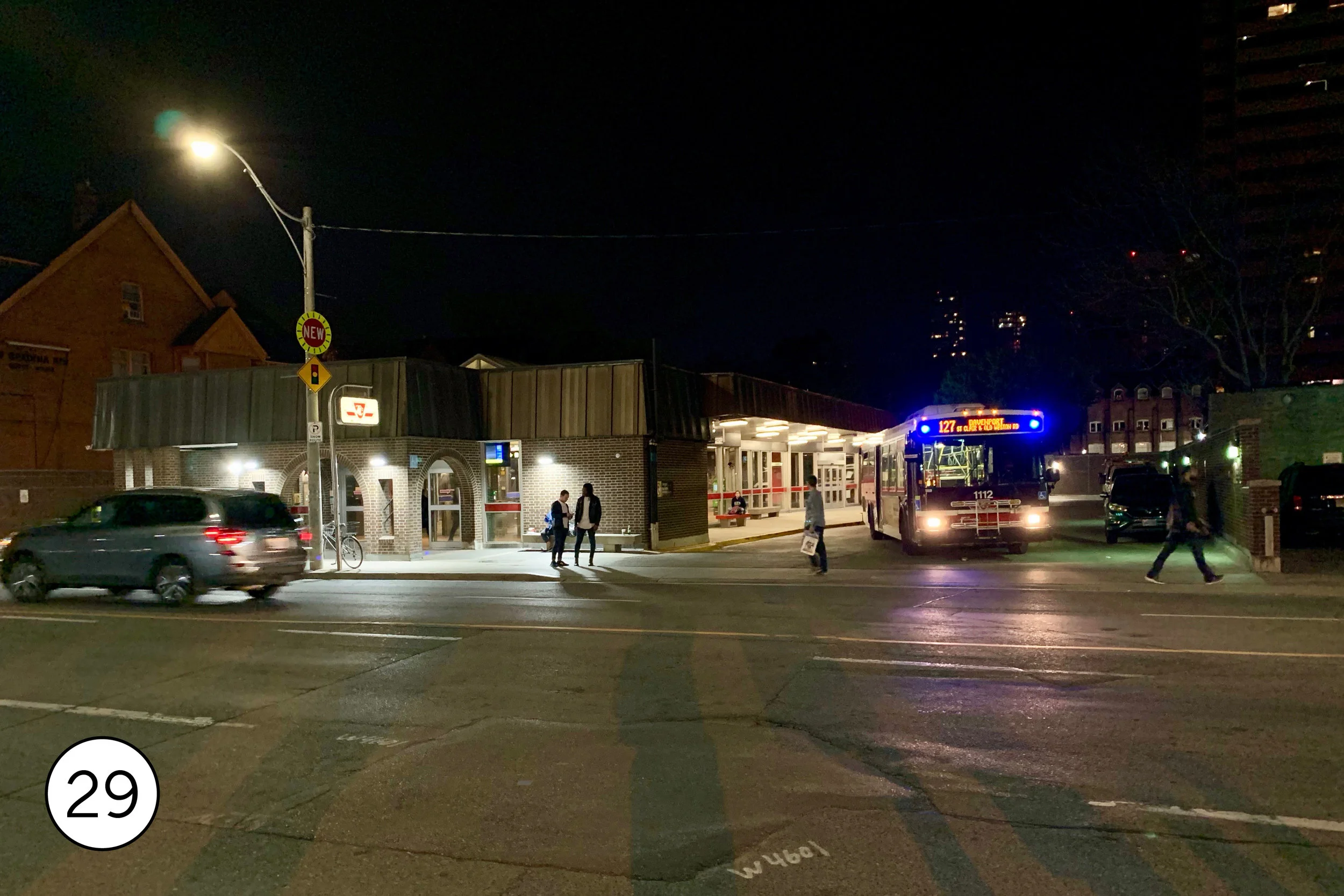
The subway is fully integrated with the streetcars and buses above. Montreal’s transit system is a grid — buses and streetcars run east-west or north-south. Nearly every route intersects the subway, and where they do, stations are built to make transfers convenient and comfortable. Many stations feature aboveground bus loops like the one at Spadina [29], with the buses stopping directly art the station entry pavilions, and most of the streetcar lines terminate a similar loops, like the one at Broadview [30].


Most of the subway is in the old city of Toronto. At the outer ends, it connects to suburban transit. At Kipling Station[31], for example, at the west end of Line 2, a huge bus terminal serves 13 TTC routes. at the other end of Line 2, at Kennedy Station[32] the subway meet the Scarborough RT, now called Line 3. Intended as. cheaper way to extend to the suburbs, it was designed as a grade separated streetcar line but then built using ICTS automated technology developed by the Urban Transportation Development Corporation, which was owned by the province of Ontario and provided politically valuable jobs. That same technology proved to be very successful in Vancouver, but in Toronto it would be a one-off. Instead, politicians have pushed for full-sized subways, and the subway has been expended north into car-oriented suburbia. The current plan to replace the aging Line 3 is a full underground subway. This would end at Scarborough Centre[33], a shopping mall and civic complex that serves as the heart of Scarborough, a once independent city amalgamated into Toronto in 1998. These suburban downtowns, often very well served by transit, are a distinctive feature of the Toronto region.


The Go Transit network, operated by Metrolinx, the regional transit agency, links the city to Greater Toronto. In many ways, it created the template for modern commuter rail in North America. It was the first new system after World War II, the first designed around park-and-ride lots, and the first to use the now ubiquitous Bombardier double deck cars. It’s also typical in offering very limited off-peak commuter rail service. If current plans hold, though, Toronto could take the lead in reimaging commuter rail, with electric trains and all day, 7-day-a-week frequent service.
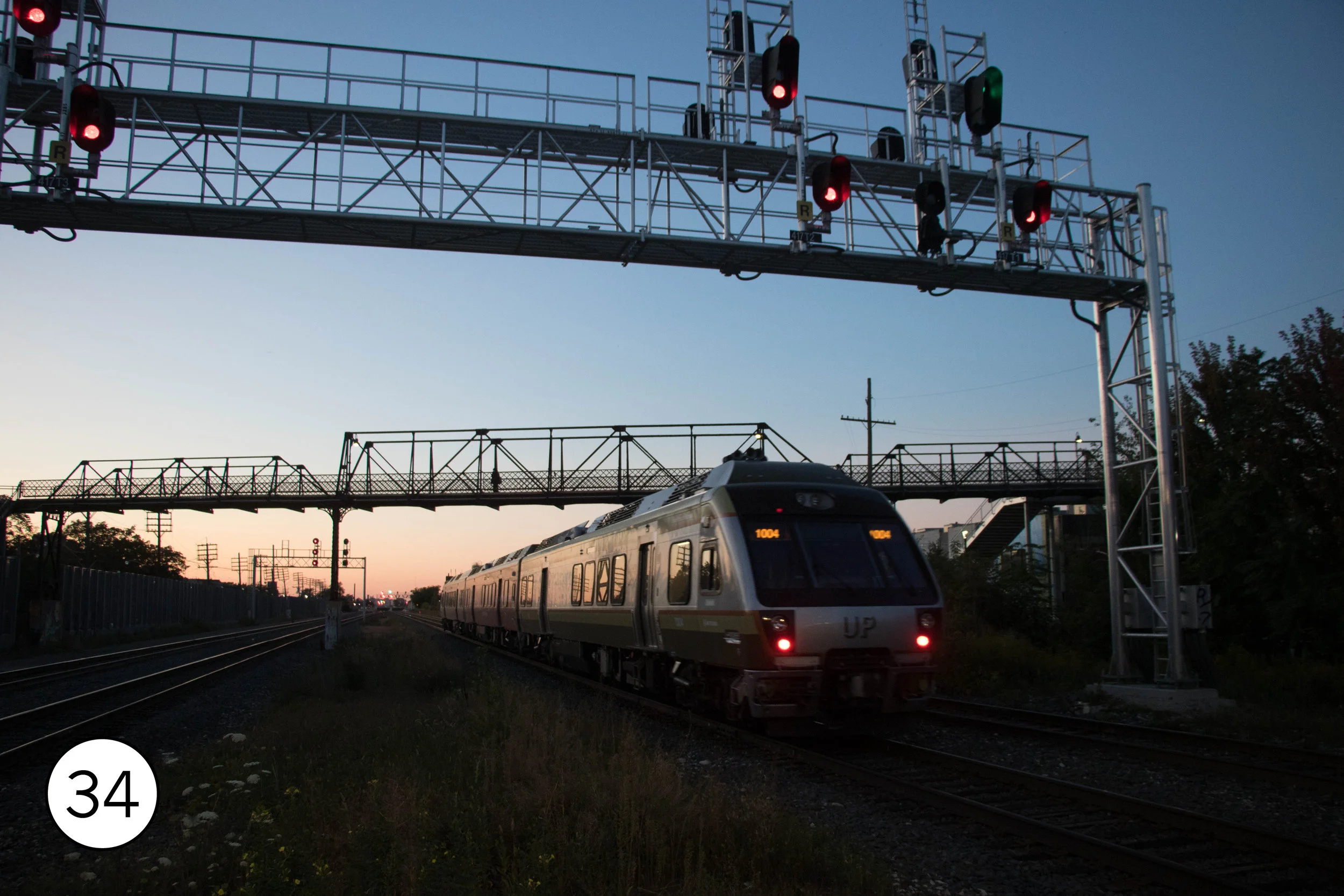
Most freight rail bypasses central Toronto, so the tracks in the core are dominated by passenger rail. The platforms at Bloor Station[34] and the adjacent pedestrian bridge are a great place to see GO trains on the Kitchener and Milton lines as well as the every 15 minute airport express trains and occasional Via Rail trains. Bloor is easy to access by subway and streetcar. (Notably, one section of the platform is high for UP express platforms while the rest is low level for GO.) Another good spot to photograph GO is from the Brown’s Line overpass at the Long Branch Stationon the Lakeshore West line [35], also accessible by 501 streetcar. One of the GO’s major rail yards is just down the line at Mimico [36], visible from the platform.
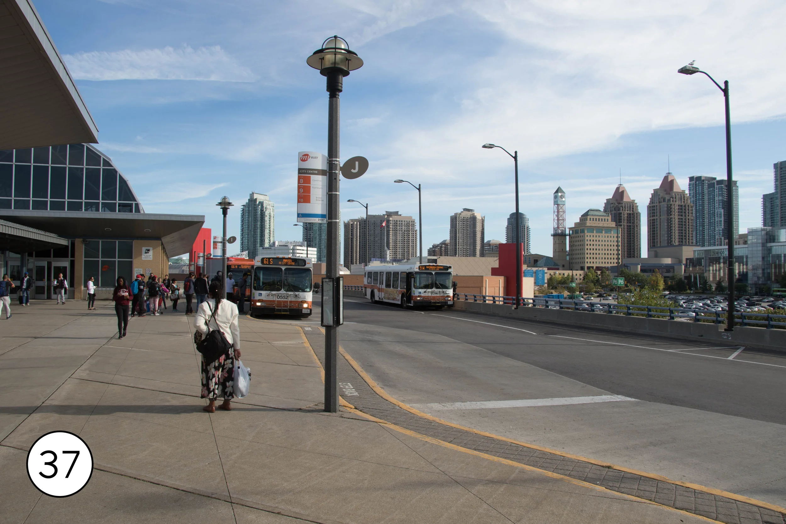
GO is not just a commuter rail system. 61,000 of its 276,000 weekday boardings are on an extensive regional express bus system. While many of these routes radiate out from Union Station in Toronto, GO has a lot of suburb-to-suburb surface, too, connecting to other GO routes and local transit at hub like Square One[37] in the downtown of Mississauga, a short walk away from the postmodern civic complex that was intended to give this sprawling city a civic identity.


Toronto’s suburban transit networks are extensive and busy.. TTC ends at the Toronto city line; beyond that is the domain of Miway (serving Mississauga, pop. 721,599) YRT (Serving York Region, pop. 1,109,909), Brampton Transit (pop. 593,638). All these have over 100,000 boardings per day.
Two of these suburban networks have built high quality BRT. Miway’s Mississauga Transitway operates as a freeway express service west of Square One, then uses an elevated busway. Central Parkway[38] is an elevated station, resembling heavy rail in everything but the rubber tires. From here, it takes its own grade separated path through suburban office parks. The transitway hosts both all stops BRT service and express buses; stations like Tahoe [39] are designed with passing lanes so the express busses can pass through without stopping.
To the north of Toronto, York Region Transit is developing an extensive BRT network branded as Viva. Most of these liens are the median of suburban arterials. The pink and purple lines, for example, have 3 miles of center running bus only lanes on Highway 7, includingHwy 7/ West Beaver Creek station[40]. At Enterprise Boulevard, they then follow a new transitway through the middle of a massive mixed use development. Further to the west, where 7 turns into a grade separated freeway, the buses run on the shoulders. Hwy 7/ Bayview station[41] shows the level of investment in this network, which, even though it’s already one of the biggest networks of dedicated BRT lines in North America, isn’t yet close to full buildout; large sections still operate in mixed traffic awaiting construction of transitways. Viva connects to the Toronto subway at Vaughn Metropolitan center (which has a large BRT stop immediately outside the subway station) and at Finch, though the Finch line is still in mixed traffic. It also meets three GO lines. Toronto’s suburban transit expansion continues; one of three new light rail lines being built by Metrolinx is a north-south line on Hurontario in Mississauga and Brampton, connecting to Miway BRT and GO trains.


Getting around
The regional smart card, Presto, works on all the train operators, including the airport train. You can buy a Presto at any subway station or at the airport train station. After buying the $6 (all amounts are in Canadian dollars) card, you cna load it with value. A one way TTC ride on Presto is $3.10. Cash fare is $3.25. Subway stations also sell tokens (3 minimum) for $3..10 each.
For TCC service the paper day pass can be a really good deal for exploring at $13 Canadian a day. You can buy it at most subway stations from the agent. They accept credit cards.
Getting there
The Union Pearson Express runs from the airport to Downtown Toronto for $12.25 Canadian. The 900 Airport Express connects to the subway for $3.25.
Via Rail is Canada’s somewhat inferior version of Amtrak. Toronto has fairly frequent connections to Ottawa (4 1/2 hours) and Montreal (5 hours.) There’s also joint Via/Amtrak service between New York and Toronto, leaving early in the morning and arriving in the evening.